Complete Property Assessment in 3 Days
Pavement, roofs, and landscaping assessed in a single drone flight. Fast, accurate condition data for budget planning and acquisitions. Complete reports delivered in 3 days with lifetime platform access for ongoing analysis.
Traditional Inspections Are Too Slow
When you need property condition data for annual budget planning or acquisition due diligence, you can't wait weeks for multiple vendors to coordinate site visits.
Three Critical Assessments
Everything you need for comprehensive property condition analysis
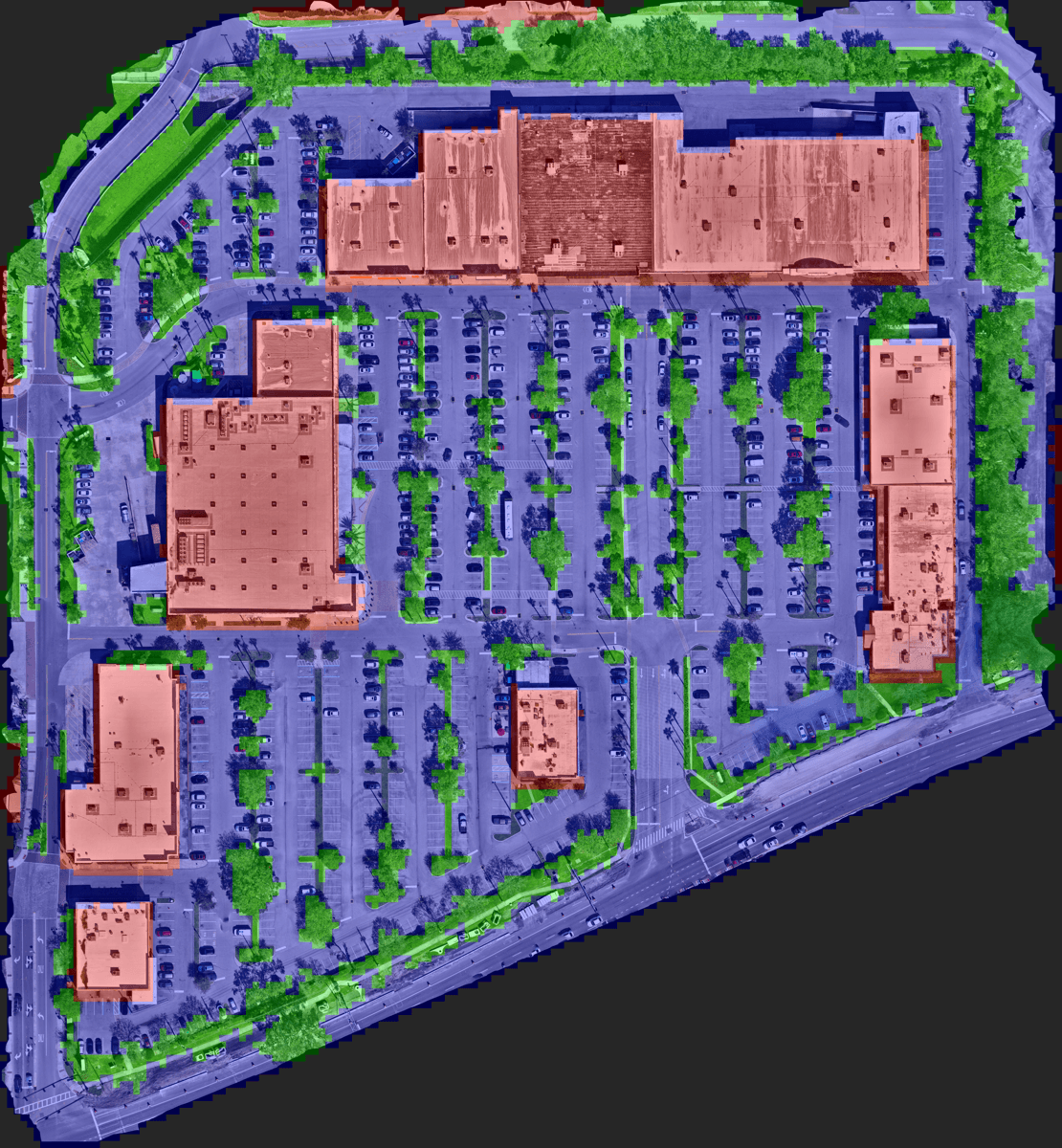
Your Property Data, Always Accessible
Every assessment includes lifetime access to our orthomosaic viewing platform. View high-resolution imagery, measure, annotate, and collaborate—anytime, anywhere.
Zero-Lag Viewing
Instant loading of high-resolution orthomosaic imagery. Zoom from overview to pixel-level detail without any delay.
Measurement Tools
Calculate distances and areas with geodesic accuracy. Perfect for planning repairs and estimating costs.
Annotations
Draw points, lines, polygons, and add text labels. Mark areas of interest and document findings.
Team Collaboration
Share access with your team members. Everyone sees the same data with real-time updates.
Export Capabilities
Download measurements, annotations, and imagery. Integrate with your existing workflows and systems.
24/7 Access
Your property data is always available. Review assessments, make measurements, or create reports anytime.
See the Platform in Action
Experience how our platform transforms property data into actionable insights
Simple Process. Fast Results.
From contact to comprehensive report and platform access in 3 days
Schedule Flight
Contact us with your property address. We coordinate with your team and schedule the drone flight.
Capture & Process
Our drone captures high-resolution imagery. AI algorithms analyze pavement, roofs, and vegetation.
Receive Reports
Get detailed PCI, RCI, and SCI reports with condition maps and prioritized recommendations.
Access Platform
View your property data in our interactive platform. Measure, annotate, and share with your team anytime.
Lifetime Platform Access
After receiving your reports, continue analyzing your property data through our interactive platform. Measure, annotate, share with your team, and export data anytime.
Built Different
We're a lean team with our own drone network and AI algorithms. No bloated overhead. No long-term contracts. Just fast, accurate property data with powerful platform tools.
3-Day Turnaround
From flight to final report in days, not weeks. Make decisions faster.
Comprehensive Data
PCI, RCI, and SCI in one assessment. No need for multiple vendors.
No Lock-In
No long-term contracts. You own your data. Work with us when you need us.
Ready for 3-Day Property Intelligence?
Contact us to schedule your assessment. We'll respond within 24 hours.
Get in Touch
See a Sample Report
Download our complete PCI, RCI, and SCI report to see what you'll receive.
Download Sample Report